Streamline energy processes through automation and intelligent analytics.
Reduce carbon footprint by promoting clean and sustainable energy solutions.
Seamlessly incorporate solar, wind, and other renewables into the energy mix.
Build a robust and adaptive grid infrastructure to withstand disruptions.
Lead with cutting-edge digital technologies to meet evolving energy demands.
Deliver smart, responsive, and user-centric energy solutions.
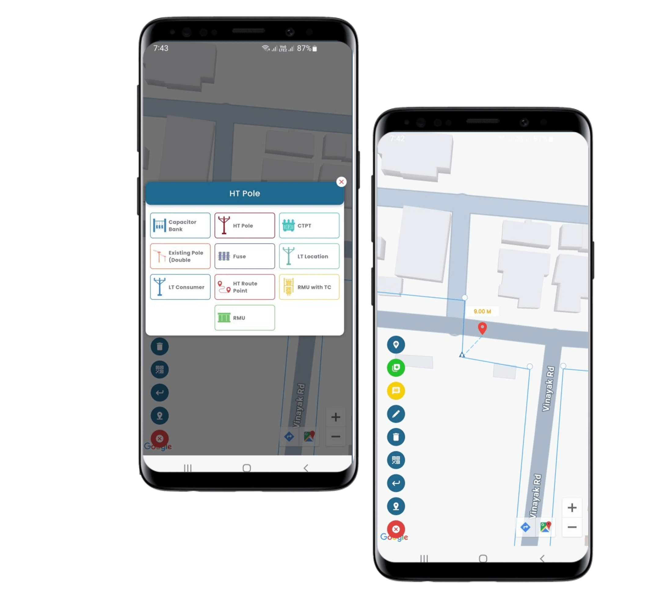
Mobile Application for Capture Geospatial Data & Advanced Utility Network Modeling.
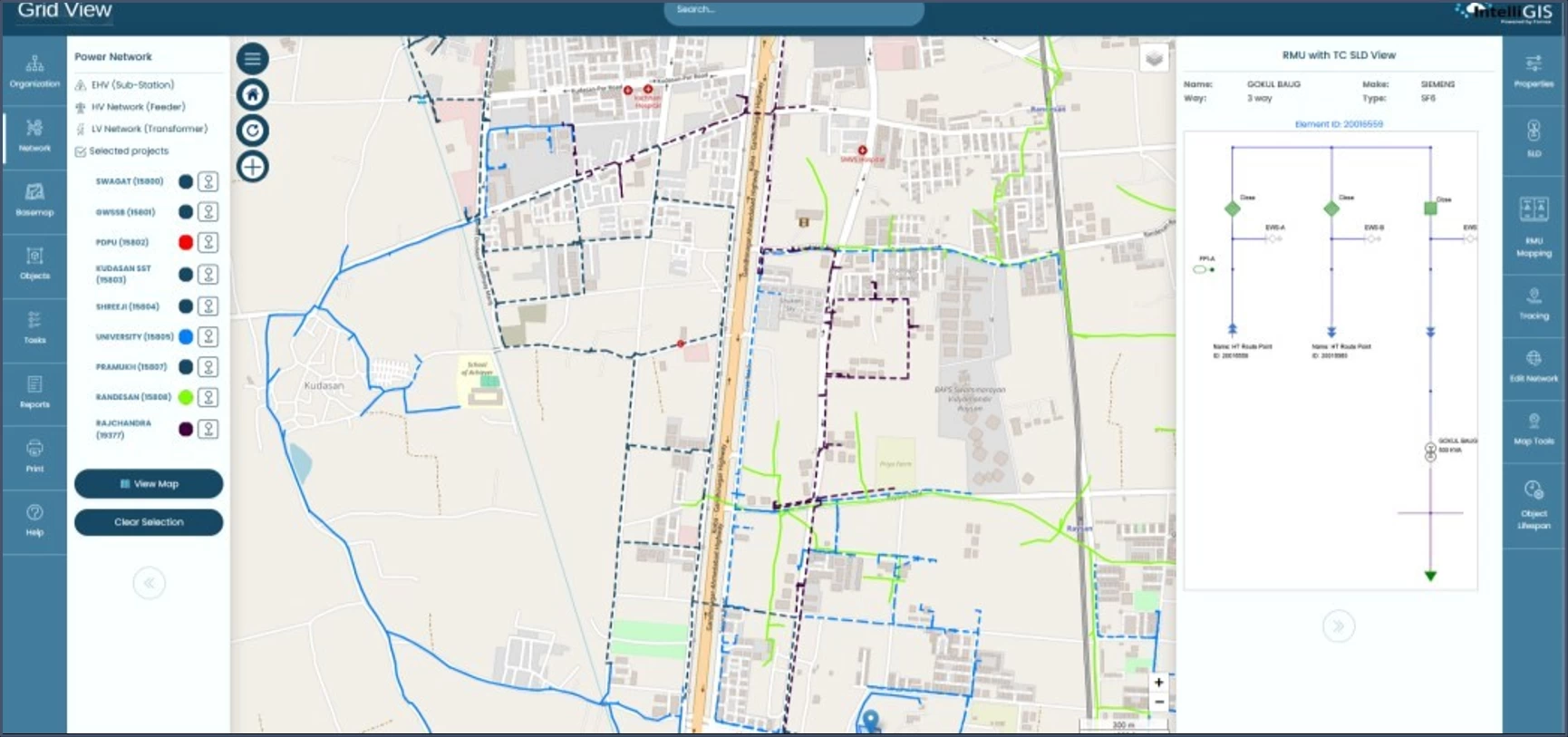
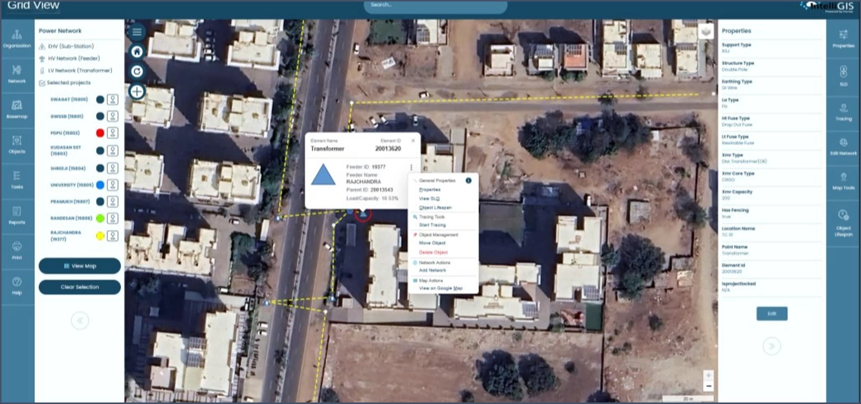
Interactive Map View of Electrical Network Showing All Attribute Data.
Multi-Layer GIS Data Visualization for Spatial Analysis.
API-Centric Data Modeling for Interconnected Applications.
User-Centric Dynamic Reports for Data-Driven Decisions.
Our GIS software meets OGC standards for seamless interoperability while being custom-designed for power distribution networks.
Seamlessly operates on LAN, WAN, Internet, and Intranet with optimized performance.
Unified dashboard integrates GIS with existing apps for streamlined workflows.
Cloud-ready architecture accommodates growing data and user demands.
Modular design allows AI/ML integration and future upgrades.
Successfully implemented in similar projects with high performance metrics.
APIs and database connectors enable bidirectional updates between GIS and other systems.
Role-based access, encryption, and audit trails ensure data security during exchanges.
24/7 maintenance, training, and compliance with global security standards.
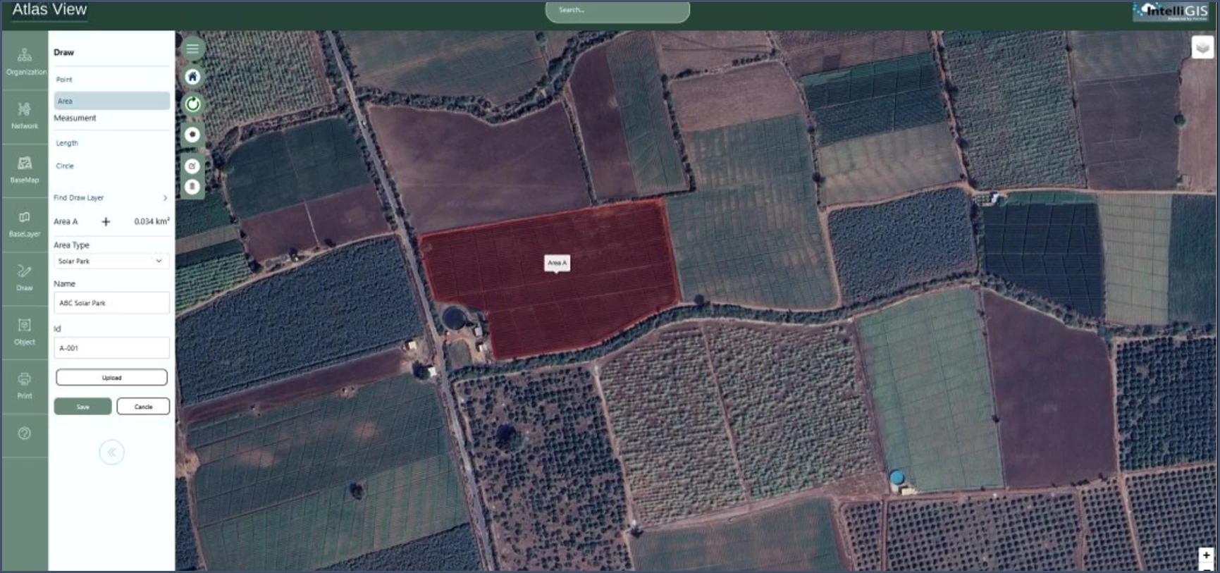
Design flexible forms with multiple question types for precise field data collection.
Support for Capture Points, Lines, and Polygons with real-time GPS/GNSS accuracy.
Secure, role -based access ensuring users interact only with the data and functionalities relevant to their profile.
Specialized tools for mapping electric infrastructure and consumers.
Interactive maps with features like zoom, pan, dynamic labeling , cluttering/decluttering, and network tracing.
Comprehensive modeling of HV, MV, and LV electrical networks, assets, and customer locations with GPS accuracy.
Secure, role -based access ensuring users interact only with the data and functionalities relevant to their profile.
Manage the full lifecycle of network assets from planning and installation to maintenance and retirement.
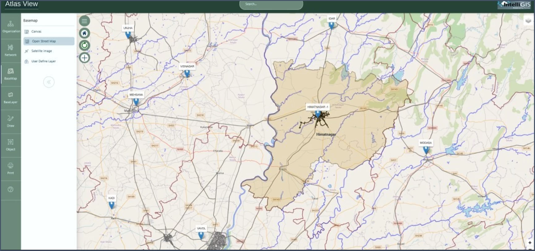
Unified Infrastructure Visualization
Electrical Networks: All power grids, substations, and distribution networks are mapped on a GIS-based platform for real-time monitoring and planning.
Multi-Layer Data Integration: Overlays additional infrastructure layers like: Transportation (roads, railways, ports, airports).
Multi-Modal Connectivity Planning
Synchronized Infrastructure Development: Enables planners to optimize road, rail, and utility alignments while avoiding conflicts.
Satellite Imagery Backdrop: Visualizations over high-resolution satellite imagery (e.g., Starlight imagery) enhance situational awareness.
Supports Common Information Model (CIM) standards, enabling structured extraction of network data.
Facilitates integration with Distribution Management Systems (DMS), Outage Management Systems (OMS), and Advanced Distribution Management Systems (ADMS).
Integrates with SCADA/DMS systems Supports both full network exports and incremental updates. Includes error tracking and validation mechanisms.
Provides access to industry standard databases through integrated data adapters.
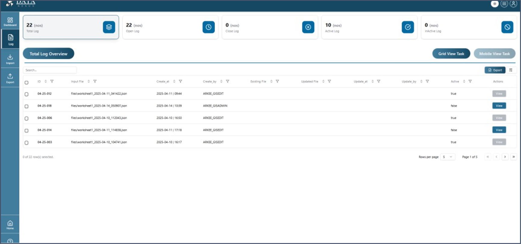

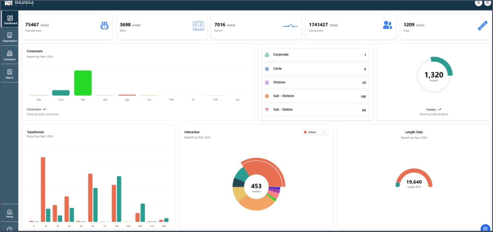
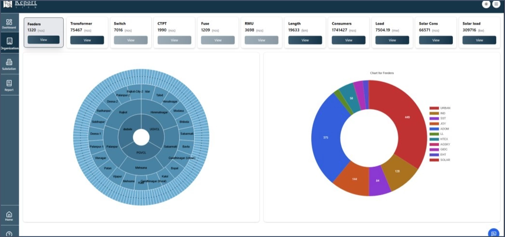
Generate reports based on organizational hierarchy (Circle, Division, Subdivision) or network components (Substations, Feeders).
Create geo -referenced maps, PDF map books, or paper plots for field crews.
• Reports include charts/graphs for better data interpretation.
• Export options (PDF, Excel, CSV) and automated scheduling for
regular updates.
Dynamically display selected object attributes as labels for printing/plotting.
AGIS is a next-generation Geographic Information System (GIS) designed specifically for the management, analysis, and optimization of electrical distribution networks. It offers a unified platform that integrates network modeling, asset management, customer indexing, and advanced geospatial visualization, all while ensuring seamless interoperability with enterprise systems like SCADA, ADMS, OMS, and billing applications.
AGIS empowers utilities to streamline operations, enhance service reliability, support digital transformation initiatives, and future-proof their network management processes through advanced mapping tools, customizable dashboards, and integration-ready architecture.